
Documents · History
Wollochet Heights Estates plat maps
Finding copies of the original Wollochet Heights Estates plat and the second addition, including the sheet that draws Park Lake.
Archive
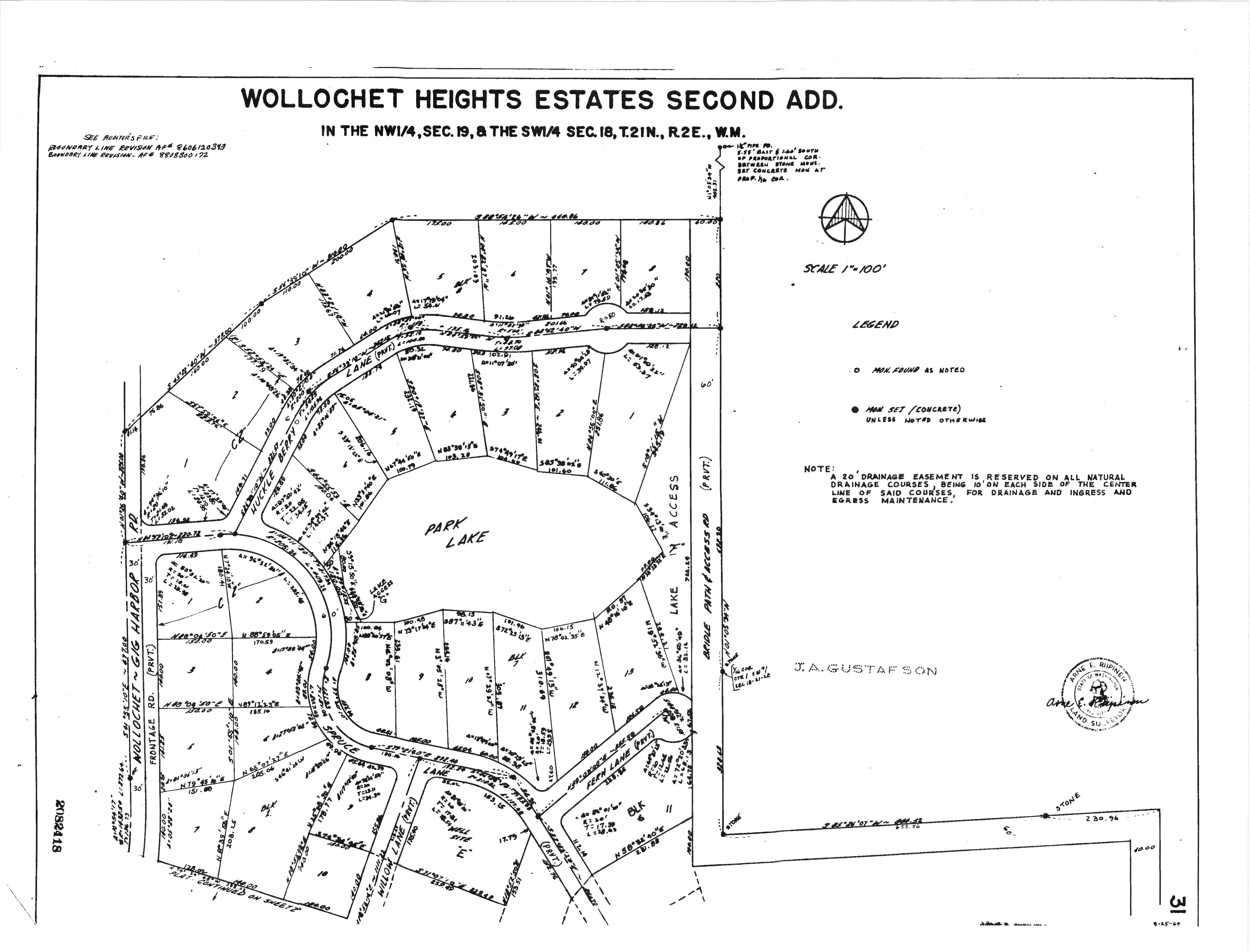
These are owner-kept scans of the Wollochet Heights Estates plat and the Wollochet Heights Estates Second Addition. The first plat is the 1962 map of the subdivision. The second addition is the later map that draws Park Lake and the lots around it. They are finding copies for the owners’ file, not a title report.
If a sentence here disagrees with the sheet, the sheet wins. If the sheet disagrees with the copy on file at the Pierce County Auditor, the recorded plat wins. Open the page you need below.
- Wollochet Heights Estates, sheet 1 of 3 (opens in a new tab)
The map sheet. Northwest quarter of Section 19, Township 21 North, Range 2 East. Blocks, private lanes, and the engineer’s certificate.
- Wollochet Heights Estates, sheet 2 of 3 (opens in a new tab)
Description, dedication, easements, private-road note, and county approvals, including the Auditor’s filing block.
- Wollochet Heights Estates, sheet 3 of 3 (opens in a new tab)
Protective covenants filed with the plat: residential use, building standards, view restrictions, and the water-system provision.
- Second Addition, sheet 1 of 5 (opens in a new tab)
The sheet that labels Park Lake. Scale 1 inch to 100 feet, monument legend, and the 20-foot drainage-easement note.
- Second Addition, sheet 2 of 5 (opens in a new tab)
Continuation of the plat, including Gay Lake, the proposed recreation area, and Maple, Willow, Spruce, and Hemlock lanes.
- Second Addition, sheet 3 of 5 (opens in a new tab)
Continuation of the plat, including Park “A,” Birch Tree Lane, and Maple Lane Circle.
- Second Addition, sheet 4 of 5 (opens in a new tab)
Legal description, dedication, and the county approval and Auditor filing blocks for the second addition.
- Second Addition, sheet 5 of 5 (opens in a new tab)
Additional dedications of the lots brought into the second addition.